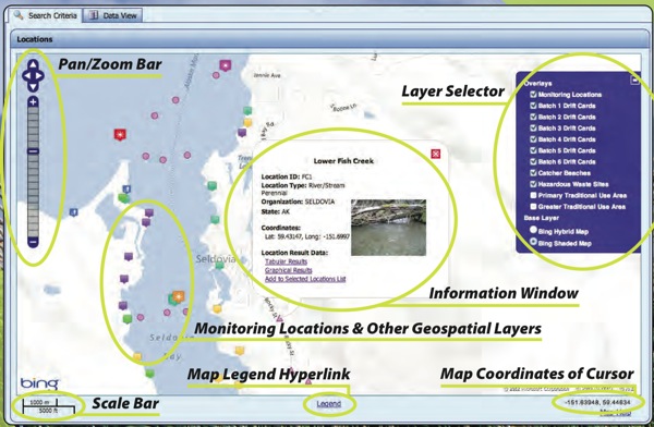
The Seldovia Village Tribe’s Node/Spatial Viewer provides the public with geospatial and environmental data collected by the Tribe and other organizations. Our Node is a server on the National Environmental Information Exchange Network that serves as the exchange point for all data submissions to the EPA. The SVT Spatial Viewer is a rich Web-based application that makes physical, chemical, biological, and habitat data from Kachemak Bay fresh and marine waters available to visitors to the SVT Node/Spatial Viewer website. It provides querying mechanisms that display query results in tables as well as graphs and allows users to sort, filter, and export data. In addition, the Spatial Viewer includes additional GIS map layers with the following geospatial data: monitoring sites, drift card release and retrieval points, local “catcher” beaches, hazardous waste sites, and subsistence use areas.

Node/Spatial Viewer


Category
Kachemak Bay Studies, Local Collaboration, Restoration Project, Scientific Studies, Sea Otter ResearchAbout This Project
Want to learn more about the Exchange Network? Here are some tribally focused links to get you started!


